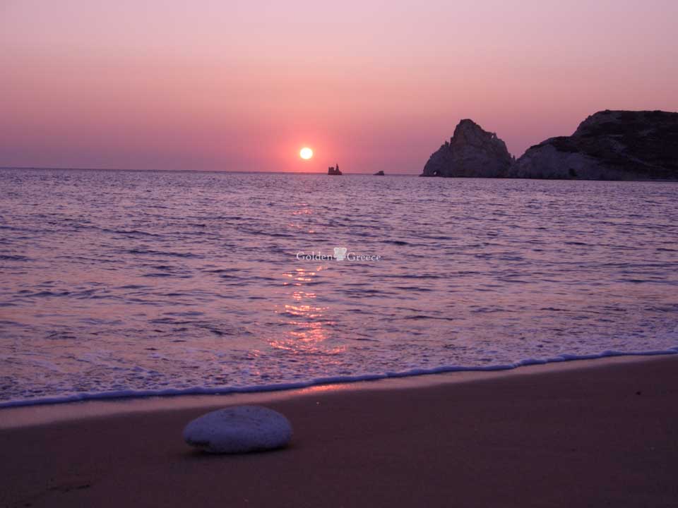
The largest part of the island is volcanic. Therefore, the variety of rocks presented by Kimolos is remarkable. Characteristics of rare rocks found on the island are perlite, betonite or chalky earth and kaolins. Kimolos also has deposits of semi-precious stones, such as opal, quartz and amethyst. In addition to the rocks, it also has special flora and fauna. On the shores of Kimolos, the visitor can admire the Mediterranean seal and the cormorant up close. In the highlands of the island, the blue lizard, the viper and the golden owl catch the eye.
The vegetation consists mainly of scrub and sparse bushes, alternating with traditional crops. This type of vegetation shows high biodiversity. In total, 185 plant species have been recorded on the island, of which 32 are considered particularly important, as they are endemic, rare or even threatened. Near the coasts, on rocks above the sea and on the slopes exposed to the wind, the "coastal" hydrangea prevails, with the main representatives being the centaurea spinosa and the staghorn (Cichorium spinosum). Towards the interior, the dominant species are the linden (Cistus), the heather (Erica manipuliflora), the lavender (Lavandula stoechas) and, more rarely, the sedge (Sarcopoterium spinosum). Among the scrub there are sparse or denser discontinuous scrubs ("garig") with snakes (Juniperus phoenicea) and sedge (Pistacia lentiscus). Thicker bushes ("maquis") are found mainly in gullies with the dominant species again being the snake, the rail and the wild olive (Olea europaea). Natural vegetation is now beginning to invade the abandoned terraces as well.
In Polyaigo, because the only human intervention is free animal husbandry and indeed of low intensity, the vegetation is characterized by the presence of denser bushes, especially in the numerous streams that descend from the mountains to the coasts, with snakes, wild olives and, more rarely, sedges (Arbutus unedo ) and foxtails (Phillyrea media). On the slopes of the mountains, the bushes alternate with stony areas with sparse vegetation or with bare rocky masses. The intense relief with the numerous small valleys and ravines creates a variety of habitats, which favor the existence of a corresponding variety of species. The poorest soils are covered by heather with dominant species such as heather, ladania, alifona, helichrysum italicum etc. The coasts on both islands are mostly rocky, where amaranth (Limonium) and fennel (Atriplex halimus) grow. A variety of plant species can be found in the small wetlands and sandy beaches that form at the mouths of the streams.
On the two islands, we find a wide variety of aromatic plants that are also used in the local cuisine, such as capers, fenugreek, thyme, thyme, rosemary and many others. In autumn and winter, housewives gather wild mushrooms and herbs. Finally, several plants are known for their medicinal properties and are used as medicine even today.
Route 1: Chorio - Xaplovouni - Agios Nikolas - Karras - Goupa
Duration: 2 hours
You start from Kampos, the central square of the Village and go down towards Psathi. In Fourno take the left fork and just after the Agricultural Cooperative turn left, following the orange arrows. The cobblestones up to the top are among the most beautiful and are kept in excellent condition. Just before reaching the top, turn right to visit the little chapel of Pantokrator. It is usually closed, but the view of the eastern coast of the island and Polyaigo will compensate you for the climb. You continue along the plateau towards Mylos. This area is called Xaplovouni from a detour of the name Klapsovouni, as it is said that there the sailors' wives gazed at the ships and cried, missing their men. As evidenced by the numerous threshing floors and half-ruined mills, the area used to be bustling with life. If you don't have much time, from the mills you can go down to the other side of the Village. To continue, turn right and proceed along a paddock in the same direction, with the Leek mine in your sight. After 300m you start going down towards the gas station. The road-stream is not in the best possible condition, as it is no longer used. You cross the asphalt and reach Ag. Nikola. You continue along the coast to the south, at first on a path and then on a dirt road, which finally ends in the Village. If you are not too tired, we suggest you turn left just before Ag. Nektarios, go out into the sea (a dip is all you have to do) and continue along the coast, through the picturesque houses and the wires of Goupa.
Route 2: Chorio - Skiadi - Mavrospilia
Duration: 3 hours
Start from OTE and just before Ag. Eustathius turn left following the blue arrows. The first hour of this route is shared with the route that leads to Paliokastro. To exit the village, at the first junction you will turn right and where the road ends turn left. Some branches with smaller paths will hardly confuse you as long as you always continue on the wider and in most places well-paved cobblestone. About half an hour later you pass the Ag. Anargyrou and a little further to the left, outside the road, the Prophet Elias. About 45-50 minutes from the Chorio, you should turn left while still following the blue and red arrows. Alternatively, you can come to this point with your own means of transport, from a dirt road of medium passability. The path, a little narrower than before, it continues along the slope, while on your right the peak is Sklavos (you can see the transponder of OTE). As you leave Sklavos behind you, the path splits in two with a sharp fork: for Skiadi you will continue straight while for Kastro you will turn right. Already from this point Skiadi is visible and although the path is not very well marked, it is difficult to get confused. This is a rare geological formation, which looks like a mushroom and is the result of wind erosion. If you want to continue towards the sea, from Skiadi you will descend to the NW (i.e. to the right of the path you were on), following this wears the red arrows). Going down the slope, you will find a road about a meter wide, which continues between stone fences and ends at Mavrospilia beach.
Route 3: Chorio - Paleokastro - Hagioklima
Duration: 3.5 hours
Follow the route to Skiadi, except that at the intersection, just before leaving the Slave behind you, you will turn right (towards B) following the red arrows and continuing to have the Slave on your right. This route has an impressive view of the western rocky coasts of the island. Immediately north of Sklavos is Paliokastro, which is also the highest peak of the island. The path passes by its western side but does not continue to the top. For those who want to enjoy a panoramic view of the Aegean, the climb is easier from the eastern side. From this point you can return or continue to Agioklima beach. The path descends at a slight incline until you reach a hut with a stone threshing floor in front. Below you you see the bay of Agioklima which is relatively deeper than the others and has two small beaches in its mouth. Although the trail is lost for the last 200m, the descent is not dangerous.
Route 4: Chorio - Monastiria - Sufi
Duration: 2 hours
To get to the Monasteries, keep going north in a straight line, following the red arrows. The route starts from Ag. Efstathiou with downhill cobblestones, leading to a ravine, with the only stone bridge of Kimolos. You do not pass it, but take the left fork, while on your right, a little further off the path, you see the chapels of Ag. Spirit and of St. Zonis. After about 1 kilometer, you meet the dirt road coming from Klima and follow it, staying in the same direction. After about 300 meters, the dirt road where you were walking continues to the right, while you continue on your way, on a smaller dirt road. Just before the end of the dirt road, which leads to the beehives opposite, be careful not to miss the arrows on your right, which lead to the path to the Monasteries. You go up the slope from the right side of a small ravine towards a half-demolished house, which can be seen on the saddle. Before starting to descend, it is worth a stop to enjoy the view of the Monasteries, while opposite, from west to east, you see Serifos, Antiparos , Sikino and Folegandros. The descent needs a little attention because in some places the path has been damaged by the rains. The small church belongs to Panagia and celebrates on August 15. To get out to Soufi, you cross the entire beach and at the end of it head to the left and immediately to the right. At Sufi, you will find shade while the place is ideal for swimming, because it is warm in all weathers. it is worth a stop to enjoy the view of the Monasteries, while opposite, from west to east, you can see Serifos, Antiparos, Sikinos and Folegandros. The descent needs a little attention because in some places the path has been damaged by the rains. The small church belongs to Panagia and celebrates on August 15. To get out to Soufi, you cross the entire beach and at the end of it head to the left and immediately to the right. At Sufi, you will find shade while the place is ideal for swimming, because it is warm in all weathers. it is worth a stop to enjoy the view of the Monasteries, while opposite, from west to east, you see Serifos, Antiparos, Sikinos and Folegandros. The descent needs a little attention because in some places the path has been damaged by the rains. The small church belongs to Panagia and celebrates on August 15. To get out to Soufi, you cross the entire beach and at the end of it head to the left and immediately to the right. At Sufi, you will find shade while the place is ideal for swimming, because it is warm in all weathers. The small church belongs to Panagia and celebrates on August 15. To get out to Soufi, you cross the entire beach and at the end of it head to the left and immediately to the right. At Sufi, you will find shade while the place is ideal for swimming, because it is warm in all weathers. The small church belongs to Panagia and celebrates on August 15. To get out to Soufi, you cross the entire beach and at the end of it head to the left and immediately to the right. At Sufi, you will find shade while the place is ideal for swimming, because it is warm in all weathers.
Route 5th: Chorio - Ellinika
Duration: 2.5 hours
The starting point of this route is Agios Charalambos. Continue on the asphalt that leaves the village and at the second small alley turn right and immediately then left, following the brown arrows. The route follows a cobblestone path, which in some places has been replaced by a dirt road, with a wonderful view of the southern beaches of the island. It is worth a stop at the chapel of Ag. Panteleimon to see the little church and enjoy the scenery. About 600 meters further down the road continues to the left and exits the main road. Turn right (towards Greek) and at the second fork, before the road starts to climb, left. Continue until you reach the beach of Deka. The continuation of the beach to the north is Hellenic and immediately after Mavrospilia.
Route 6: Upper Myrsini - Faros (Polyaigos)
Duration: 3.5 hours
It is difficult to give directions on this route, so we recommend it for those who are familiar with the map, while it would be good to have a compass. From the point where the boat will leave you, in Upper Myrsini, follow the green arrows, pass behind an old house and start the ascent with the ravine coming from Kato Myrsini on your right. Climb up to the highest point of the ravine and then go along the ridge, always heading east. Leave the highest peak of the island on the right and continue heading NE. If you still have time and inclination, a detour to climb to the top is not difficult. As you go, the path becomes sharper and in front of you you see a trigonometric pillar that you have to pass. As can be seen from the map, the descent to the lighthouse is from the north side of the bay. The blue-green waters of the bay look great from above and in the summer a dip is a must. If you accidentally find yourself on the south side of the bay (to the right as you see the sea), do not attempt to descend, but turn back to take the path again.