

The ancient city of Corfu, located at a distance of 4 km. south of today's historical Center, it extended approximately to the center of today's Kanoni peninsula, surrounded to the SW by the Halikiopoulos lagoon and to the NE by the gulf of Garitsa, where its two ancient ports, the Yllaiko port and the port of Alkinou, respectively were located.
The Yllaiko port, naturally shaped by a spacious, leeward bay, was the first military port of the city that simultaneously served its commercial traffic. Gradually, the port was equipped with the facilities necessary for its operation. Recent excavations have identified the remains of a neorio (tarsanas, carnagio), confirming the use of the port from the Archaic to the Hellenistic period.
Gradually the port deteriorated due to alluvium formed by the accumulation of mud from the rivers that flow into it. This fact combined with the great naval, commercial development and the military needs of the city, led the people of Corfu to turn their attention to the second natural port of the peninsula, the port of Alkinou. In ancient times the sea intruded deeper into the land and the coastline formed a gulf with a narrow opening. During the 5th c. BC the port was completed with port facilities, as evidenced by the findings of a vessel and a vessel, the remains of which were found in the area of Paleopolis and near the Trimartyros church, certifying the use of the port from archaic times to the 1st century. BC when the whole city was destroyed by Agrippa's troops. To protect the narrow entrance of the port, jetties were built. Excavations found it under the foundations of the church of Ag. Athanasiou (18th century) the jetty whose eastern end ended in a rectangular tower built according to the isodome system. The information mentioned by Skylax in his work that the city had a third port has not been confirmed by excavations to date.
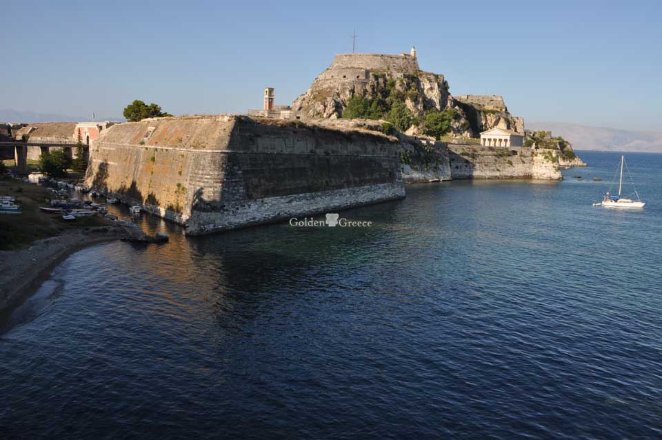
During the classical period the ancient city was walled to the north. The wall, having as its starting point the Yllaiko port, was directed towards the east and ended at the port of Alkinou. Near the port there was a gate which was protected by a tower which is preserved to this day. This tower, known as the tower of Neranjiha, was built according to the isodome system (4th century BC) and escaped destruction because it had been incorporated into the Byzantine church of the same name of Panagia. At the southern end of the peninsula is a section of wall and gate, confirming the view that the ancient city extended to this area. The Acropolis of the city is theoretically located in the east of the peninsula, in Analipsi, where there is a hill at the top of which is the church of Ag. Marina. However, this view has not been substantiated by excavations.
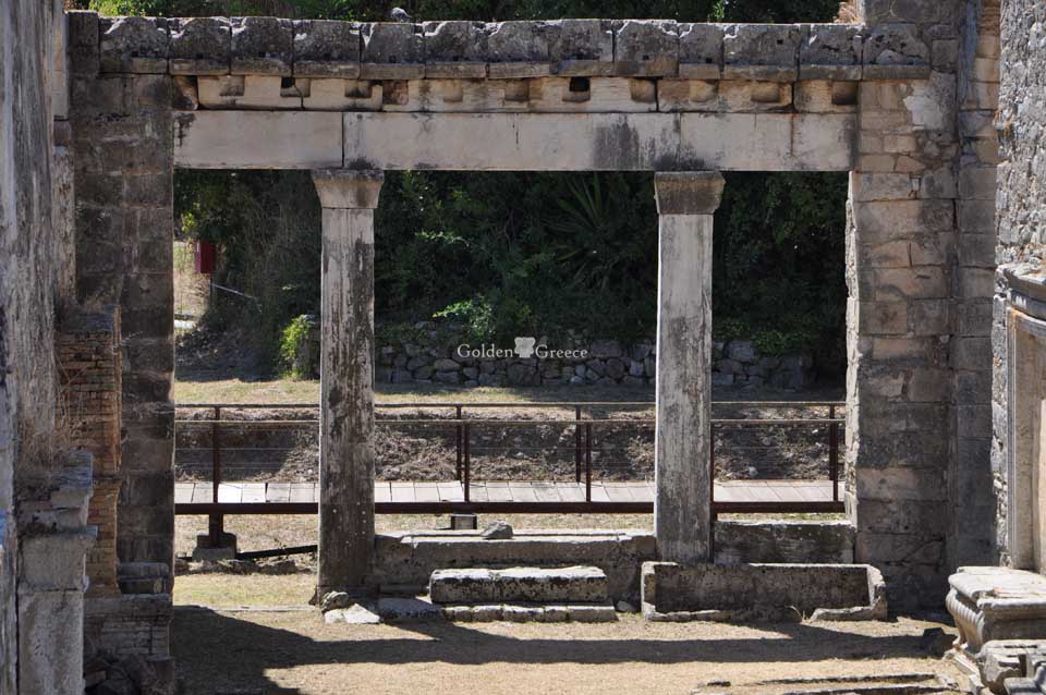
Near the port of Alkinou, in today's Paleopolis (a later name for the ancient city), was the Agora of the ancient city in which there were sanctuaries, public buildings, and the residences of wealthy citizens. The market plan has not yet been clearly defined. However, it is possible that the remains found during the systematic excavations belonged to sanctuaries. During Roman times the known important buildings established in the market were a conservatory and a platform. Later, during the 2nd c. A.D. near the market a bath complex (Terme) was built with an excellent water supply and drainage system, which had facilities for cold (frigidarium), warm (tepidarium) and hot (caldarium) baths.
In the eastern part of the peninsula, in today's Mon Repos estate, at the end of the 7th c. BC a magnificent, Doric, limestone stone temple of "Hera" was built with clay ceramic tiles protected by a strong enclosure. The inscription on part of a stone from the second half of the 5th century. BC TAS AKRIAS (of Akria) does not give us a reliable indication of the attribution of the temple to Hera, because Athena also had the nickname Akria.
Around 430 BC this temple was replaced by a classical one, which was destroyed in the 1st century. BC Southeast and outside the "Heraion", an archaic, open-air mosque dedicated to Apollo Korkyraeus was founded, consisting of a table-shaped precinct, in the middle of which there is a square altar. During the classical era, outside the precinct of the "temple of Hera", various auxiliary buildings were established with a hitherto unknown use, while during the Hellenistic period a rest house was added for the pilgrims to rest.
At a distance of about 300 m. S.E. of "Heraion" was built around 500 BC "the temple of Kardaki". It is a Doric temple without superstructure, with six columns on the roofs and eleven on the long sides. In the western part of the nave was an eskara or an altar which indicates the chthonic character of the temple. However, the temple to this day has not been attributed to a specific deity.
At a distance of about 200 m., east from the tower of Neranjiha, near the Yllaiko port, in the current area of Ag. Theodoron, there was an archaic temple dedicated to Artemis that dates back to 590 - 580 BC. It is a Doric, pseudo-dipterous temple with a pronaos, three-aisled nave and back building with eight columns on the narrow sides and seventeen on the long sides. The temple was made of ashlar and had a clay roof, which was replaced around 530 BC by a marble one. The western pediment, which is the oldest surviving stone pediment, is preserved from Artemisium, which depicts Gorgo - Medusa with her children Pegasus and Chrysaora.
East of the temple a 28 m road led to an altar whose parapet was decorated with triglyphs and metopes alternately. North-east of Artemisium, at a distance of about 150 m., the remains of a third sanctuary were found, consisting of a temple of which only the nave was revealed and of the altar located to the east. The temple and the altar date back to the second half of the 5th century BC and were tentatively attributed to the sanctuary of Apollo Pythaeus, to which probably also belongs the demarcation mark of the sanctuary with the inscription "MOUNT PYTHAEOS".
The finding of a part of an ancient pediment with a representation of a Dionysian banquet in the present-day Figareto district in Kanoni, allows the assumption that the sanctuary of Dionysus existed nearby.
Unfortunately, the temple of Zeus, Alkinou and the sanctuary of Dioskouri mentioned in philological evidence have not yet been identified by excavations.
The urban planning of the ancient city was based on the "horseshoe system", according to which wide streets (plazas) started from the market in a north-south direction and intersected vertically with narrower streets (stenos) that ran from east to west.
The excavation data concerning the residential architecture of the ancient city prove that the houses were built in districts. In fact, it is certified that the wealthy classes lived around the market area and these private residences dating from the archaic to the Roman period contained courtyards, baths and peristyles. Instead, those belonging to the productive classes and slaves lived around the area of the Hyllic harbor and their dwellings consisted of a few simple rooms distributed around a courtyard with a well, serving only the basic needs of living.
For utilities such as water and sewerage, the evidence is very patchy. The aqueducts of the ancient city have not been excavated. Hypothetically, they are placed in the area of Kardaki. However, their existence is confirmed through the presence of wells and clay pipes that were discovered in many places.
Editor: Fotini Anastasopoulou