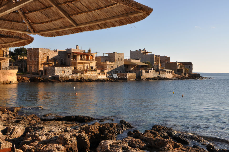
The archaeological site of Zarakas is located at the southern end of a small peninsula in the bay of Gerakas, on the eastern coast of Laconia. In this area, where traces of prehistoric habitation were also found, the fortified wall of the city and the acropolis of Zarakas was probably built during the Hellenistic era (3rd century BC). According to the traveler Pausanias, the city took its name from the Lacedaemonian hero Zarikas who founded it between 1300 and 1200 BC.
A sanctuary of Zarakas actually existed in Attiki. Zarikas or Zarakas was the son of the king of Karystos Petraeus.
Zarakas was located in the south of the regions of Thyreatida and Kynouria disputed by the Argives and Spartans in ancient times and it seems that several times it was at the center of the dispute between the two Peloponnesian powers over the boundaries of their territory. That is why its naturally fortified position was reinforced with impressive walls during Hellenistic times.
After the battle of Thyrea, in the year 547/6 BC, it should have been part of the territory of the Spartans, while Philip II after the battle of Xaironia (338 BC) bequeathed the area to Argos. The year 272 BC it suffered great destruction from Cleonymus, the son of Cleomenes of B' who had asked for the help of Pyrrhus, king of Peru, in order to take power from Areas, his brother's son.
According to Polybius, the king of Sparta, Lycurgus, in 219 BC. during his surprise campaign to capture six cities in the southern Argolis, he failed to capture Zarakas and Glyppia in Kynouria. The impressive walls, combined with the steep eastern side of the acropolis, perhaps explain the reasons for its failure.
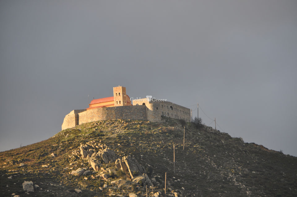
In Roman times, the city belonged to the Common of Freemen. Zarakas the "blessed village" according to the description of Pausanias, in his time, the 2nd century. A.D. rather it presented an image of abandonment. However, buildings from Roman times are today visible in the free space between the inner and outer walls, while a three-aisled Christian church was built inside the acropolis during late antiquity.
In later times, Zarakas belonged to the territory of the Metropolis of Monemvasia, as mentioned in a golden bull of the year 1301, of the Byzantine emperor Andronikos II. According to travelers the area was later called "Porto Bottas", while Pouqueville mentions the name "Porto des tonneaux" and Leake the name "Porto Cadena".
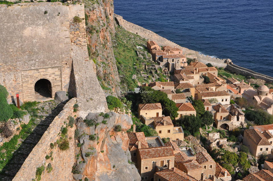
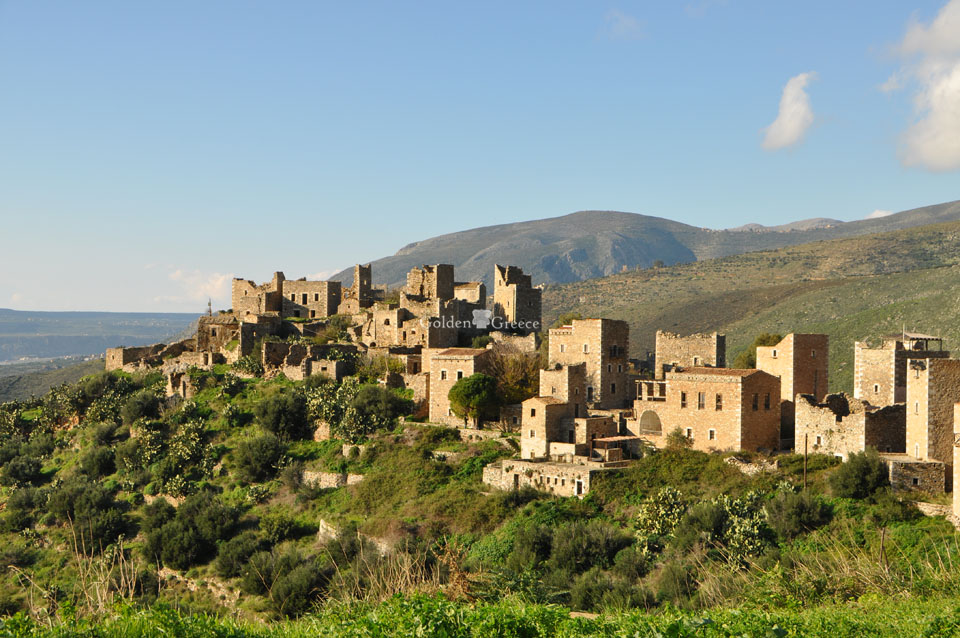
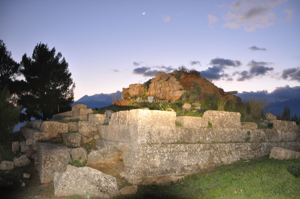
Today, the visitor to Gerakas faces the walls of the ancient city and the citadel of Zarakas on a hill above the port. The entrance to the acropolis is through a fairly well-preserved gate, an excellent example of the fortification technique of the Hellenistic times. Remains of Roman times are also visible high up in the space between the two defensive walls.
The defense of the wall was reinforced by at least eight towers, rectangular or square in plan, while in some places traces of later repairs are visible. The acropolis was built on the eastern side of the area defined by the outer fortified enclosure. This last refuge in times of great danger, but also a possible place for the garrison to live, was surrounded on the north and west sides by a wall built in an irregular polygonal way, while the eastern steep slope naturally protected the acropolis. The entrance to the interior of the citadel was through an impressively preserved strong gate in the north-west corner of its wall, the defense of which was strengthened by a solid, circular in plan, tower. The gate, which can be dated to the years after 272 BC, has the form of a narrow corridor, 1 m wide, which runs north and then bends east. This narrow passage must have been blocked in cases of danger with wooden, non-permanent doors in two places. In the event of an attack, even if the first door was breached, the enemies encountered a second door down the narrow corridor and in total darkness.
During the time of the traveler Pausanias in the 2nd c. m.X. the only important building in the area of Zarakas was a temple of Apollo with the cult statue in the type of Apollo the guitar player. The remains of this temple have not been identified.
Remains of later buildings are visible today in the space within the walls. Particularly impressive is a vaulted building from Roman times, the walls of which are built with a mixed technique and are preserved to a great height. The type of building and its exact dating have not yet been determined since the site has not yet been excavated. In the area of the acropolis are also visible the remains of a three-aisled basilica that was built during the Christian years and which has also not been excavated.
The visitor to the hill easily accessible from the west, where the remains of Zarakas are preserved, is immediately impressed by the preservation of the fortifications of the Hellenistic era that were intended to protect the city. The visible remains of later times indicate the use of the site during the Roman and Byzantine eras.
Source: MINISTRY OF CULTURE AND SPORTS
odysseus.culture.gr